Mendocino Ecological Learning Center


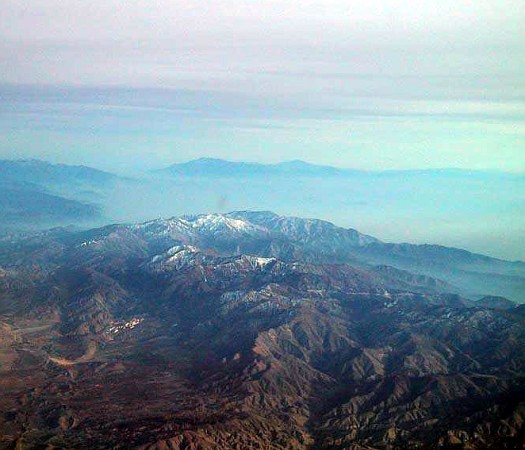
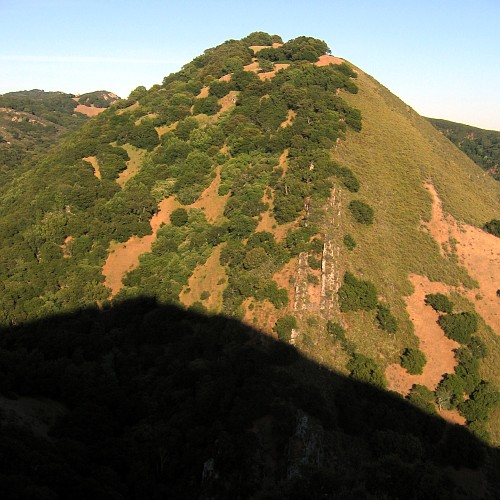
The continuous tectonic front is where the North American and Pacific Plates are sliding past each other -- where Bakersfield moves toward Mexico City while Burbank heads for Alaska. Between Bakersfield and Burbank like the San Gabriel Mountains. With the San Bernardino Mountains east of them, they trend east-west, forming a kink in the coastal ranges that come down from San Francisco and go on to Baja California. The kink conforms to a bend in the San Andreas Fault, which runs along the inland base of the mountains. The kink looks like this:
        \
         \
          \_____
                 \
                  \
                   \
It could be a tiptoeing h. It resembles a prize-winning chair. Los Angeles is like a wad of gum stuck to the bottom of the chair. The mountains are one continuous system, but its segments are variously named. The upper stretch is called the Coast Ranges. The lower leg is called the Peninsular Ranges. The kink is called the Transverse Ranges.
My hieroglyph represents, of course, not only the mountains but the flanking San Andreas Fault, which comes from the Gulf of California, bends left around Los Angeles, then goes on to San Francisco and north below the sea. . . . The East Pacific Rise, the ocean-basin spreading center away from which the Pacific Plate and other plates are moving, sinuously makes its way from the latitude of Tierra del Fuego all the way north to Mexico, where it enters the Gulf of California. The East Pacific Rise has splintered Mexico and carried Baja California away from the mainland -- much as the Carlsberg Ridge has cracked open the deserts of Afro-Arabia and made the Red Sea. Baja is not moving due west, as one might guess from a glance at a map, but north by northwest, with the rest of the Pacific Plate. The cumulative power of this northward motion presses on the kink in the San Andreas, helping the mountains rise.
That much has long seemed obvious: as the two sides of the San Andreas slide by each other, they compress the landscape at the kink. It has been considerably less obvious that a compressional force accompanies the great fault wherever it goes. In the past, the building of the Coast Ranges and the Peninsular Ranges was in no way attributed to the San Andreas Fault. A paper published in Science in November, 1987 -- and signed by enough geologists to make a quorum at the Rose Bowl -- offers evidence that the San Andreas has folded its flanking country, much as a moving boat crossing calm waters will send off lateral waves. The great compression at the kink is withal the most intense. The Coast Ranges and the Peninsular Ranges are generally smaller than the Transverse Ranges. The San Gabriels are being compressed about a tenth of an inch a year.
Why the kink is there in the first place is "not well understood." Just to the northeast, though, in the Great Basin of Utah and Nevada, the earth's mantle is close, the earth's crust is thin and stretching. In hte past few million years, the geographic coordinates of Reno and Salt Lake -- at the western and eastern extremes of the Great Basin -- have moved apart sixty miles. This large new subdivision of the regional tectonics is in every way as entrancing as it is enigmatic. Almost all of California may be headed out to sea. Already, the east-west stretching of the Great Basin has put Reno west of Los Angeles, and it may be what has bent the San Andreas Fault.
-- John McPhee, "Los Angeles against the Mountains," in idem., The Control of Nature (New York: Farrar, Straus, and Giroux, 1989), 226-8.
At Food Barn, 1835 Rumrill Blvd., San Pablo CA 94806